Drone and Aerial Photography
Drone & Aerial Photography in Birmingham, AL
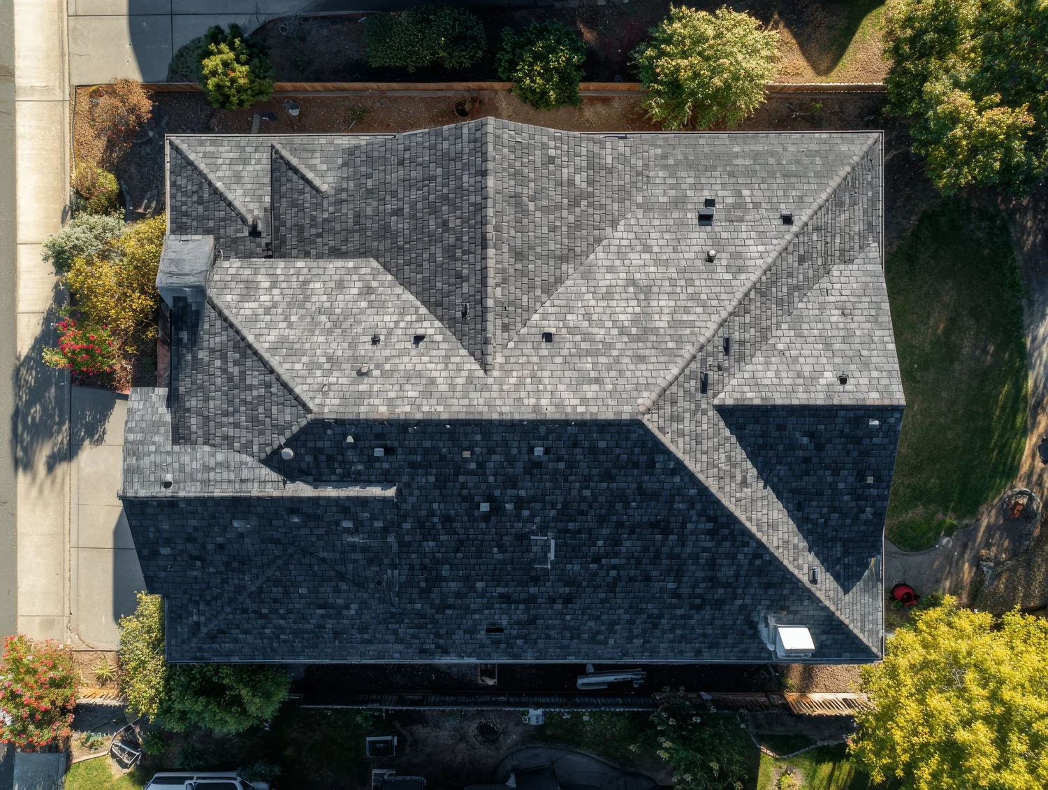
FAA Part 107 certified aerial photography for real estate, commercial property, construction progress, roof documentation and marketing across Birmingham, Hoover, Vestavia Hills, Mountain Brook, Homewood, Trussville, Chelsea, Pelham, Alabaster and surrounding Alabama communities.
Aerial Services
What I Photograph from the Air
Real Estate
Aerial exteriors, lot lines and neighborhood context that show what ground photos can't.
Construction Progress
Repeatable angles on a schedule for owners, builders and lenders.
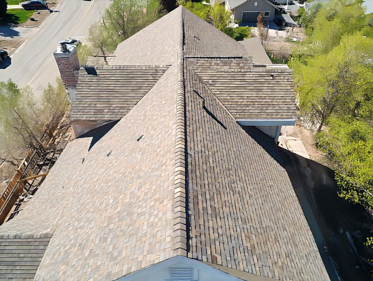
Roof Documentation
High-resolution roof images for records, maintenance and estimates, without a ladder.
Commercial & Marketing
Buildings, campuses, venues and events from a fresh angle.
Booking Process
How It Works
Tell Me About the Site
Address, what you need, and when.
I Check Airspace and Weather
I confirm the plan and price.
I Fly, Edit and Deliver
Delivery is through a secure online gallery.
Drone Pricing
Pricing
Booked with a real estate photo package
Real estate add-ons
- 5 edited aerial photos: +$75
- 10 edited aerial photos: +$119
- Aerial listing video (30–60 sec): +$99
- Aerial roof documentation: +$149
Standalone
Standalone aerial visits
- Aerial photo visit: 15 edited aerial photos: $149
- Aerial photo + video visit: 15 photos and a 30–60 sec edited video: $199
- Residential roof documentation (single-family): $199
Scheduled aerial coverage
Construction progress
- Single visit: 20+ date-stamped aerial photos: $249
- Monthly program: 1 visit/month, repeat angles: $449/mo
- Bi-weekly program: 2 visits/month, repeat angles: $799/mo
All flights are subject to weather, airspace authorization and site safety. Typical delivery within 48 hours.
All flights are conducted in compliance with FAA rules and regulations. Where and when we can fly depends on airspace restrictions, FAA authorization, temporary flight restrictions and site safety. If a location can't be flown legally or safely, we'll let you know before booking and won't charge for a flight that can't happen.
Frequently Asked Questions
Drone FAQ
Are you licensed to fly commercially?
Yes. I'm FAA Part 107 certified, which the FAA requires for commercial drone work.
Can you fly near the Birmingham airport or in controlled airspace?
Much of the Birmingham metro is in controlled airspace. Before every flight I check airspace and obtain any FAA authorization required. Some locations need extra lead time or can't be approved. I'll tell you up front.
Is your drone Remote ID compliant?
Yes. My drone broadcasts Remote ID as the FAA requires.
Are you insured?
Yes. I'm insured through PPA (Professional Photographers of America) and FAA Part 107 certified. Proof of insurance is available on request for property managers, venues and municipalities.
What happens if the weather is bad?
Wind, rain and low clouds affect safety and image quality. If conditions aren't safe or won't produce good results, the flight is rescheduled to the first available date.
What do I receive?
Professionally edited high-resolution aerial photos delivered in a secure online gallery, typically within 48 hours when aerials are added to a real estate package. For standalone aerial projects, the delivery date is confirmed in your quote. Drone video is quoted separately.
Can you combine aerial and ground photos?
Yes. Most real estate clients pair drone images with HDR interior and exterior photos in one visit.
What areas do you serve?
Birmingham, Hoover, Vestavia Hills, Mountain Brook, Homewood, Trussville, Chelsea, Pelham, Alabaster and surrounding communities.
Can you fly at night?
Yes. Night and twilight flights are available for a small extra charge. Airspace and the flight plan are confirmed at booking.
Schedule Your Flight
Ready for Aerial Photos?
Call (205) 616-2091 or email nicholasholmanphoto@gmail.com, or send the details through the booking form.